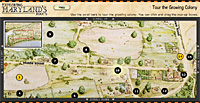
Tour the Growing Colony
http://mdroots.thinkport.org/interactives/growingcolony/
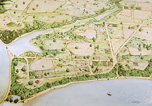 Walter Crowe's drawing of St. Mary's City. 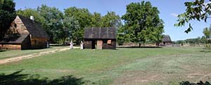 The town center 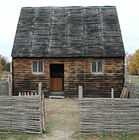 Cordea's Hope |
In this activity, you can explore the buildings, people, and activities you might have encountered in 1685. No maps or drawings of the city from the 1680s exist. But using information from archaeologists and historians, an artist named Walter Crowe was able to draw what the city may have looked like. Using his drawing, you will learn about the Maryland Assembly, crimes and punishments, growing tobacco, and much, much more.
Important buildings, plantations, and places are named on the drawing. Use your mouse to explore the city. When you click a name, a box will appear telling you about the place. If a name is yellow, you can click the link in the box to see pictures or watch video of everyday life in St. Mary's City. You can also click on the street names.
© 2024 Maryland Public Television. All Rights Reserved.